Generic selectors
Exact matches only
Search in title
Search in content
Post Type Selectors
Generic selectors
Exact matches only
Search in title
Search in content
Post Type Selectors

T-33 Crash Site

1 Review
Location Raymond, CO
Rating Difficult,
Length 6.2mi
Time 3 to 4hrs

Vehicle Types

Overview

Trail leads to historic plane-crash site.

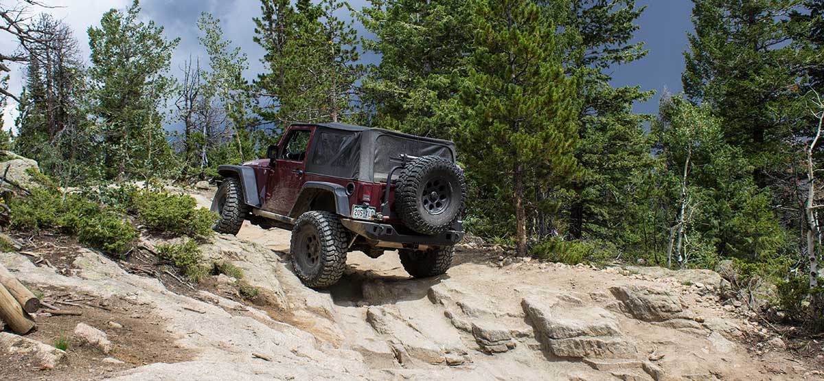
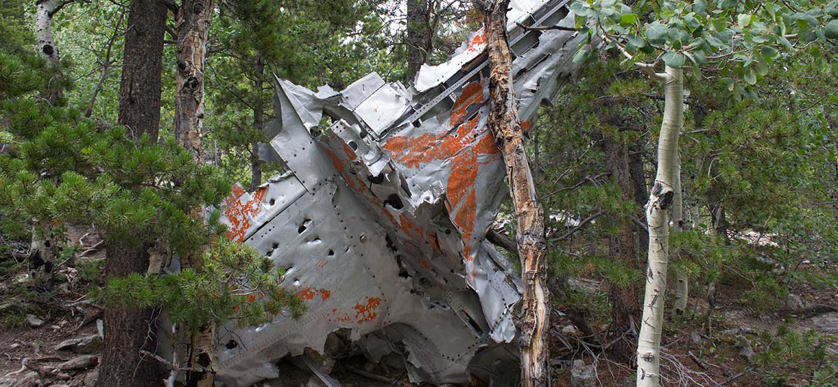
A challenging side trail off of Bunce School Road with plane wreckage at the top. The climb will test your vehicle’s articulation and ground clearance. Rental OHVs regularly use the trail. If a vehicle is faster than you and wants to pass, find a wide spot to pull over. Open June 15 through Nov. 15.

Rating

Difficult
Trail Ratings Defined

Difficult. Large embedded boulders mixed with loose rock. Minimum 35-inch tires, short wheelbase with a rear locker. Challenging tight maneuvering through trees.

Stats

Length

6.2mi

Time

3 to 4hrs

High Point

9,355

Best Time To Go

Summer/Fall

Current Conditions

(303) 541-2500Roosevelt N.F., Boulder R.D. (303) 541-2500

Check the Weather

free GPS downloads

Trail Updates

Reviews

Rate this trail on a scale of 1 to 5.


×

Mark says

Did this trail today and it was awesome! Can be pretty challenging in several places. All but a couple obstacles could be bypassed. I chose the hardest obstacles every time and made it through with just one minor scrape on the underside of the driver’s side slider right behind the front wheel. Highly recommend this trail. 2019 Wrangler JLU 4dr Rubicon. 1” coil spacers and 35” tires.
by Webolutions Digitial Marketing Agency


Cancel Agree