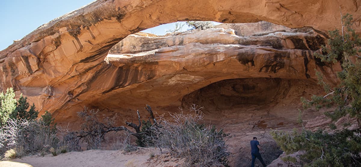
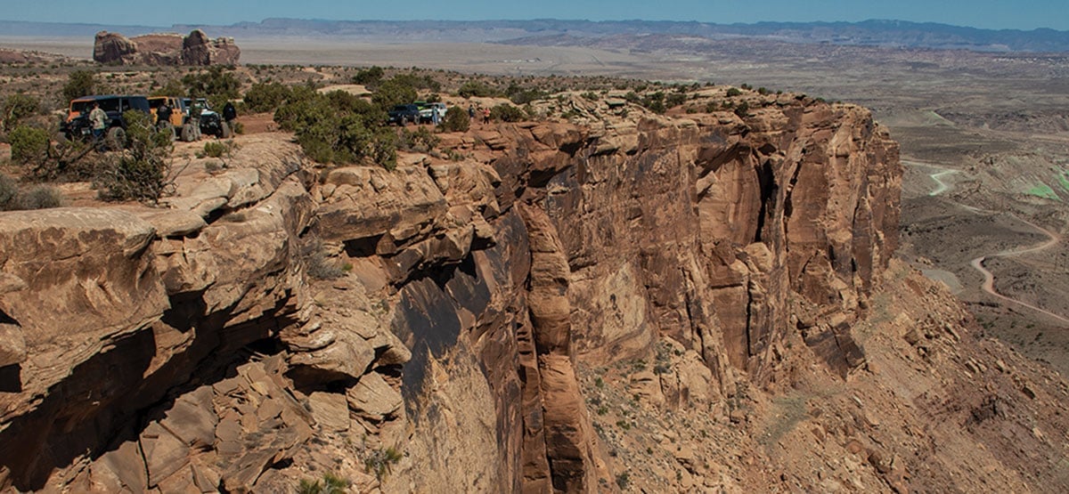
The first part of the trail follows along a high rim with spectacular views of Arches National Park and the La Sal Mountains. It then heads west between Monitor and Merrimac Buttes along a technically challenging route to Wipeout Hill. From there, it heads north past dramatic Determination Towers and exits via Tusher Wash. Optional trips to Uranium Arch and Wipeout Hill. Many other fun roads to explore on ATVs and side-by-sides. Add Wipeout Hill for maximum challenge.
435-259-2100BLM Moab Field Office, 82 E. Dogwood
Check the Weather7/15/2023
Submitted by Mark
On Page 67 of the Fourth Edition – Seven Mile Rim Trail. At Mileage 1.9, the guidebook directs users to go ‘left down the steep ledge or go straight to take the bypass’. The ledge is not a legal route. (technically, the straight ahead bypass isn’t either). The true Designated Route turns right at the top of the ledge, where the Seven Mile Rim Trail joins the Uranium Arch Trail for a short distance. Granted, this entire area is very confusing, which has made it very difficult to keep vehicles off of this ledge and out of the low lying region both below the ledge and south of Corral Canyon. Between late July and mid September 2023, fencing will be installed in this area to attempt to direct traffic back onto the designated route. At which time, both the top of the ledge and the straight bypass at Mileage 1.9 will be closed off. Thank you for providing this method to pass along trail updates. (FunTreks is looking into this report.)
10/28/2022
Submitted by Curtis
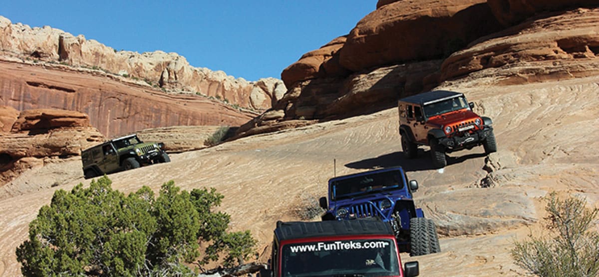
Ran this trail on Thanksgiving day 2022. Great fun in 2018 JKU with 3.5” lift on 33’s. Did the full route as described in the book solo but would suggest doing it with another Jeep. A great mix of easy and harder lines with spectacular views. The trail markings can be super confusing so keep a close eye out for white paint marks I would definitely suggest using an App on your phone if you are able. I used my rear locker in one place but probably didn’t need it. I was scared to death of “I lean” but lived to tell the story. You won’t be disappointed with this trail.
10/20/2022
Submitted by Robert
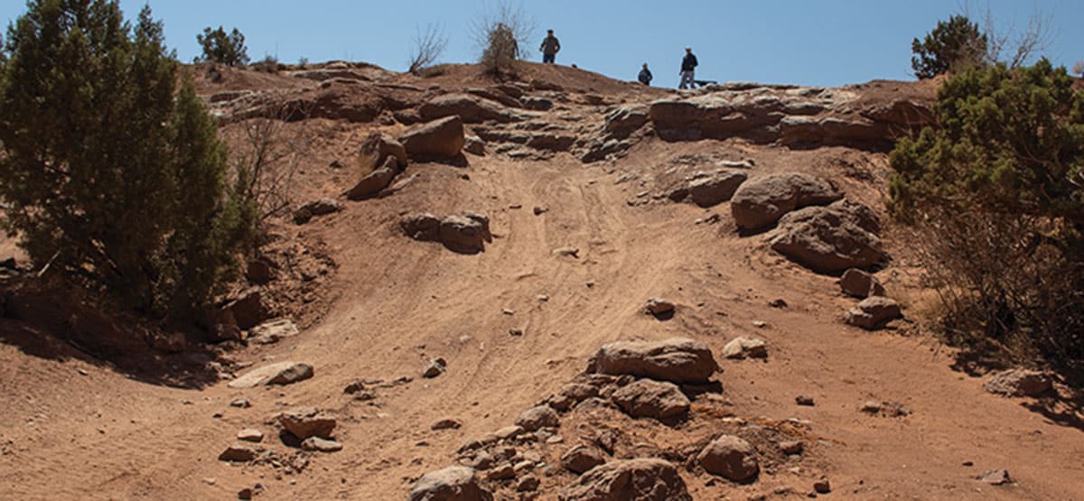
The last time we drove this trail in mid-September 2022, we had to detour because the trail was closed between waypoints 8 & 9. The BLM employee that stopped us said that the trail was closed so that work could be done on a ledge that had gotten too hard. I am sure she was talking about the ledge at GPS coordinates 38.673250, -109.748942. It had indeed gotten much harder with many people making illegal bypasses around it. FunTreks Note: The most recent 4th edition book describes this as an obstacle named “Wicked Ledge.”
2018/10/20
Submitted by Henry
Following the book at around 0.9 miles where you bear right, huge rocks fell down and are impassable.