Generic selectors
Exact matches only
Search in title
Search in content
Post Type Selectors
Generic selectors
Exact matches only
Search in title
Search in content
Post Type Selectors

Sand Creek Pass Road

No Reviews
Location Red Feather Lakes, CO
Rating Moderate,
Length 8.3mi
Time 1hr

Vehicle Types

Overview

Northern half is rougher than southern half.

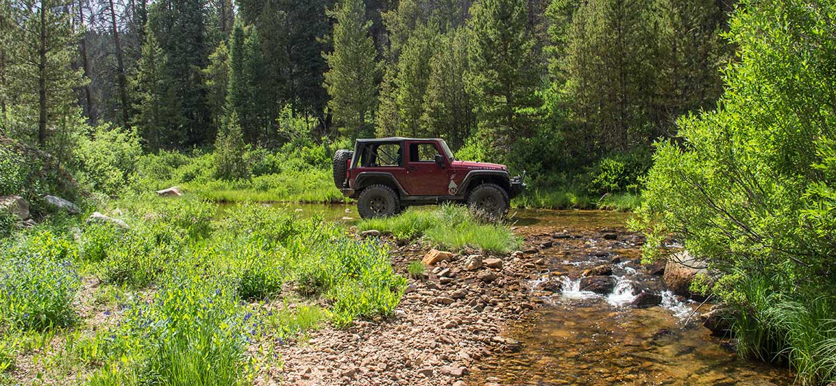
The south half of this trail is fairly flat. However, after the creek crossing, it becomes narrow, rough and steep in places as it begins a long, scenic descent to Larimer County Road. Wildflowers were abundant on the north side when we drove it in mid July. A popular OHV area because of plentiful dispersed camping and many fun side roads to explore. Area is closed in winter from Dec.1 to June 14.

Rating

Moderate
Trail Ratings Defined

This rating applies to the north half. South half is easy when dry. One water crossing has potential to get deep after heavy rains.

Stats

Length

8.3mi

Time

1hr

High Point

13,114ft

Best Time To Go

July-Sept

Current Conditions

(970) 295-6700Roosevelt National Forest, Canyon Lakes R.D.

Check the Weather

No updates yet.

Provide an Update

free GPS downloads

Trail Updates

07/17/2017
Submitted by FunTreks
A new sign at the start of this trail calls this route “Sand Creek Pass Road” instead of “Sand Creek Road.” We will be renaming this road in the next edition of the Northern Colorado book. Otherwise, we didn’t find the trail much different than the last time we drove it in 2010.

Reviews

Be the first to review this trail by clicking the button below

Rate this trail on a scale of 1 to 5.


by Webolutions Digitial Marketing Agency


Cancel Agree