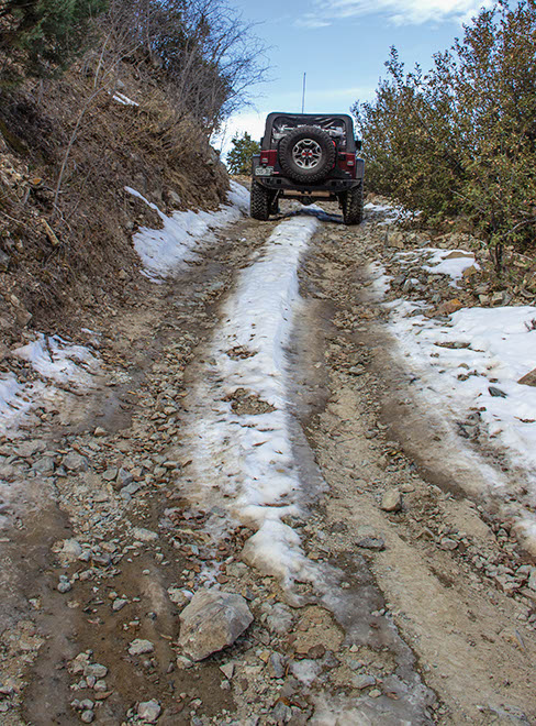
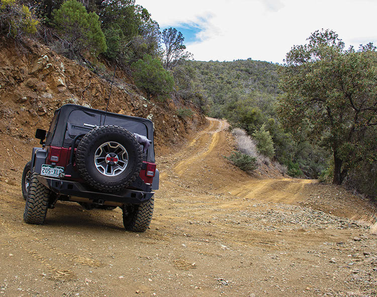
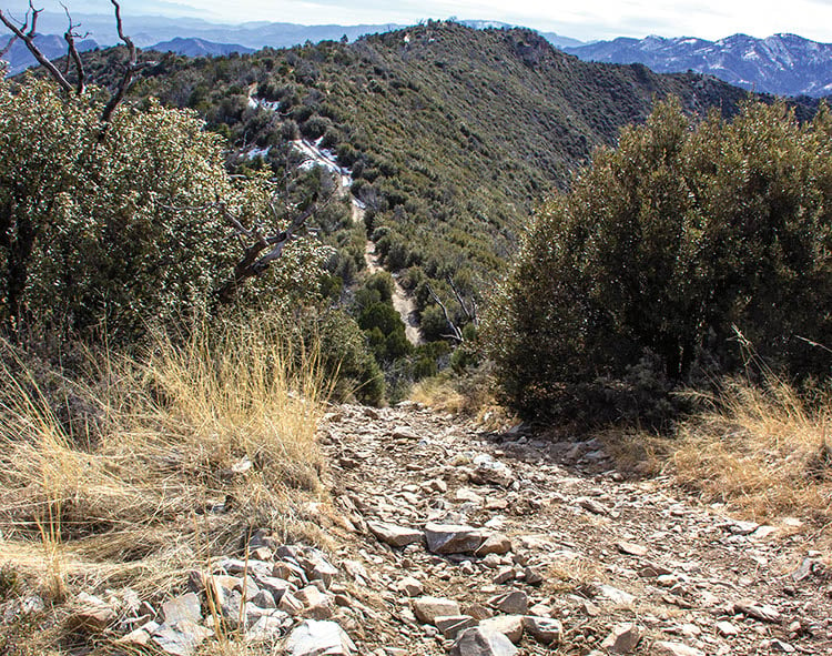
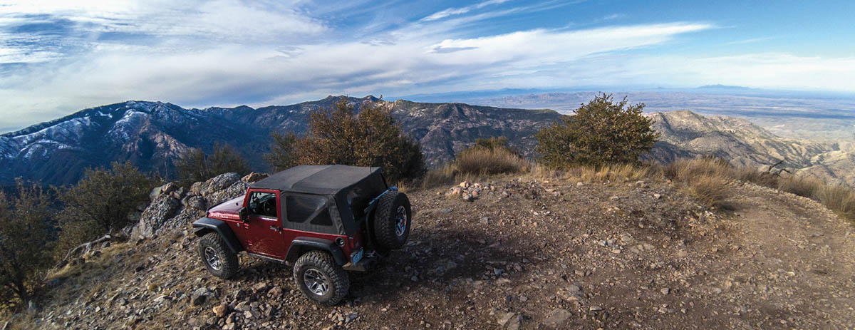
A remote and rugged trail that climbs very steeply to the top of 7,577-ft. Rice Peak. Great views on a clear day, including a distant view of the “Biosphere” experimental structure. Lots of narrow side roads for ATVs, UTVs, and dirt bikes to explore. Dispersed shady camp spots along the first part of the trail, or camp in Peppersauce Forest Service Campground just east of start. Thanks to the Tucson Rough Riders 4×4 Club for maintaining this trail.
(520) 749-8700Coronado N.F., Santa Catalina Ranger District
Check the Weather11/10/2024
Submitted by AZ Craig
Drove this in a Ford Bronco Raptor on 37s. The area that had been washed out about 1.5 miles into the trail is pretty rough. Managed to take it too quickly going up and come down on a rock at one point pretty hard, but made it back down without touching anything. Otherwise, navigating the switchbacks had some side lean, and the top was indeed very steep and loose, but not anything overly insane to get up. 4WD-Lo I would say is pretty much mandatory on this trail given the overall steepness (you gain about 3000 feet of elevation in around 5 miles). Saw a lot of hikers heading towards the top, but only a few other vehicles on the trail above the first couple of miles or so. Moderate rating seems about right; maybe borderline challenging in a couple spots, but nothing continuous.
08/02/21
The trail has a gate at the beginning with a Closed due to flooding sign on it. We understand from some people we met that the trail is washed out a little more than a mile in.
06/4/2020
Coronado National Forest temporary closure. Due to the Bighorn fire, this area has restrictions. Read forest order here. For updates go to N.F. website for alerts and notices.
5/07/2020
Submitted by Bart
Took three Jeeps there last weekend, including a stock Sahara. The road near the top has been repaired/graded. The washout/boulders previously encountered near the top are no longer there. I agree with other reviewers that the difficulty could be easily downgraded to moderate. Great view from the summit.
3/20/2018
Submitted by Richard
Book description is accurate. No surprises. Was certainly worth the trip to the top. When we thought we were at the top, we needed to look back and see that the road actually went up to the real top. The view was stunning at the top. No real obstacles getting to the top. Did not see any washouts as described in the book.
1/20/18
Submitted by Evilone
I took a group of 5 out . We had 2 jeeps, 2 FJ’s and a Power Wagon. The trail should be rated easy to moderate since it was recently graded. The grading removed all the obstacles except the last climb to the summit. Only difficulty is the tight switchbacks and steep climbs. Make sure to put the vehicle in 4 low for the final climb to prevent transmission overheating.
Great trail. Drove this for the first time in about 10 years last weekend (November 10) and had a great...See More