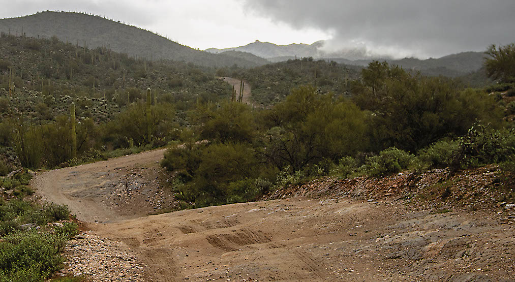
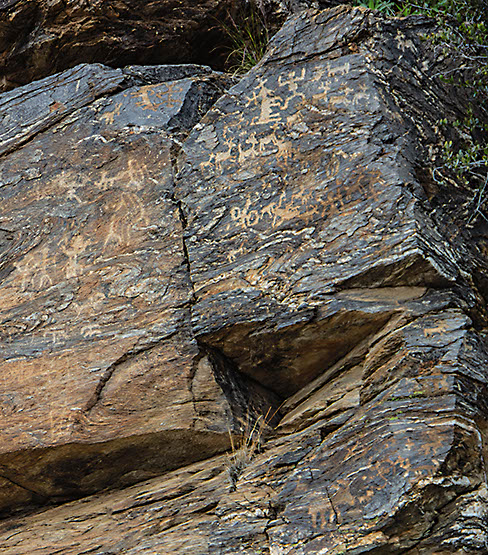
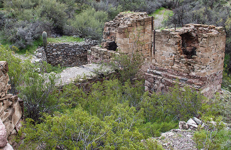
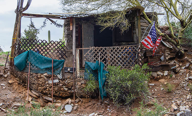
This short, fun trip takes you to stone ruins at Reymert Historic Site, an interesting mining shack and a rocky canyon with many outstanding petroglyphs. Please leave everything as you find it and take only photos. Route is open to non-street-legal vehicles. Carry a State Trust Land permit. After completing this route, you can continue south on Mineral Mtn. Road from Wpt. 06 to more difficult trails #56 and #58.
(520) 258-7200Gila District, Tucson Field Office
Check the Weather7/8/2023
Submitted by Matt
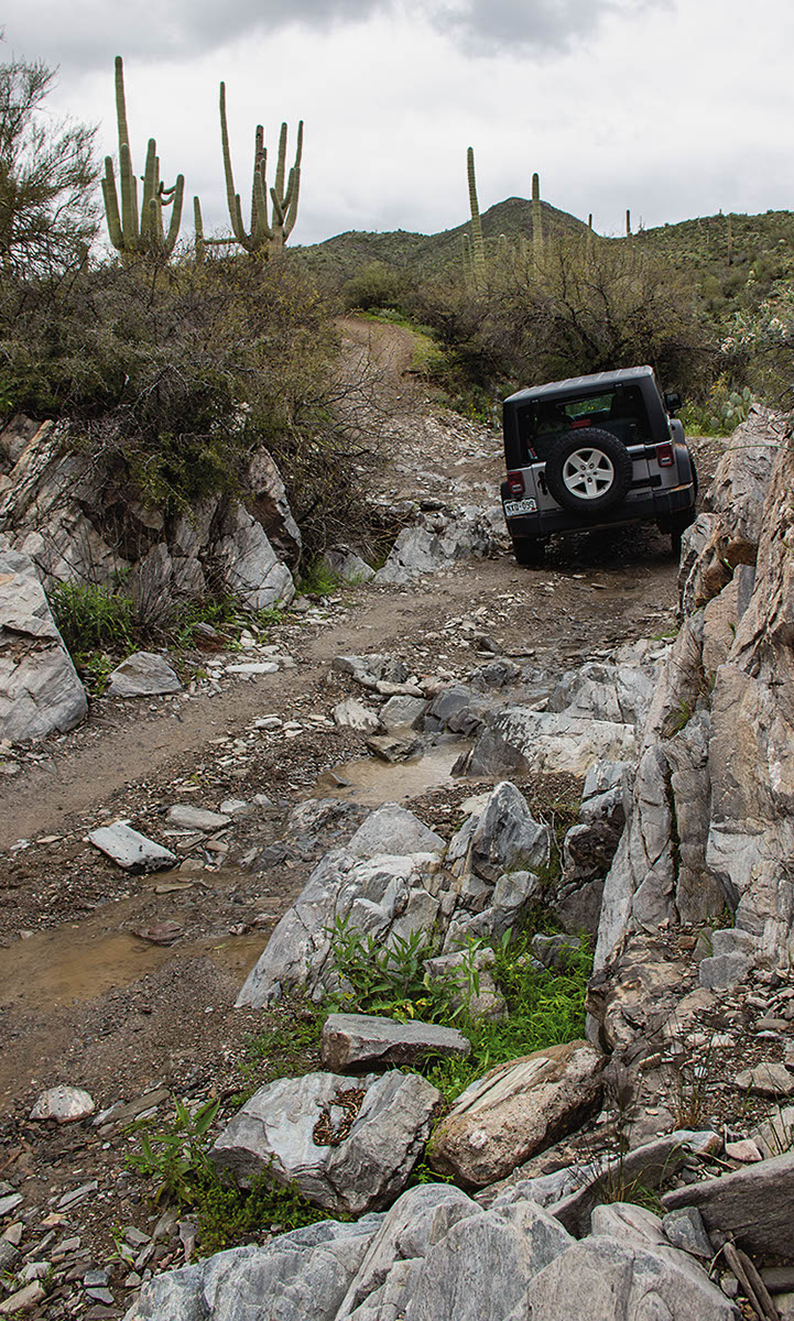
Just got back from a run in my Bronco Raptor on 37s and a Bronco Wildtrak on 35s. Overall the trail is in pretty good shape assuming you take the “easier” driver’s choice routes through. The only spot that I think is pushing into moderate is a rocky spot that’s pretty dug out and quite narrow about a quarter of a mile from the mine. I tried to line up a couple different approaches for this and was struggling not to either put my driver’s side fender flare into the rock or end up getting hung up on the right. Definitely a case of where my nearly 86″ width made something way harder than it should be. Just park and walk the very end if you’re not comfortable going through this squeeze (and I remember way less drama doing it with a 4Runner back a few years ago which happened to be 8 inches narrower).
7/8/2023
Submitted by Matt
There were a total of five Jeeps. The trail was pretty easy until reaching Point 04 on the map. It went from easy, moderate, to somewhat difficult. The terrain was rough and some of the boulders and smaller boulders had sharp edges. We almost made it to Point 05 until one of the Jeeps had two sidewall flats. While changing out the tires, we encountered a great deal of wasps. Other than that, it was a pretty trail. You have a clear view of Weaver’s Needle to the North. Between points 03-04, we encountered cattle.
12/04/2021
Submitted by Alexander
Tried to go to Reymert through U.S. 60, the road was closed by a steel gate about a mile and a half from the town.
1/10/2021
Submitted by Kevin
Pretty sure Reymert Mine is on the harder side of easy, pretty darn close to moderate, if not moderate. Nevertheless, it was an absolutely gorgeous drive. I took it in a 2021 4Runner Pro. Scrapped the bottom a couple of times.
3/12/2019
Submitted by Chuck Wells
This route is a bit rougher than the last time we did it, but we’re going to leave the rating at easy. The route to Waypoint 05 is the same, but the alternate exit we show going out past Waypoint 06 is now CLOSED at a private property gate. You can still go this way to see the petroglyphs in a narrow, rocky canyon that used to be the entrance to Lower Woodpecker (now closed). Also, you can still exit south to Box Canyon by turning left at Waypoint 07.
3/10/2019
Submitted by Tim Naylor
There is a section of Cotton Road as you exit that is closed, posted Private Property. This is on the exit trail from Reymery. A bypass is needed. The trail is blocked at N33.19935° W111.24657°
3/10/2019
Submitted by Paul
There is a private locked gate along E. Cottonwood Canyon Road that you cannot pass. This is about 7km east of highway 79 along E. Cottonwood Canyon Road. Had to turn back and go back out the way I came in from Highway 60.