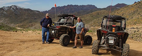
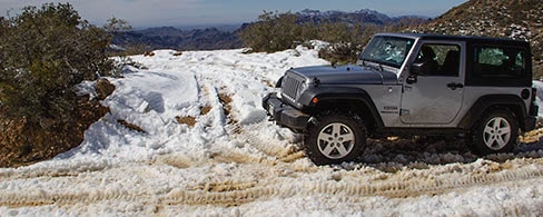
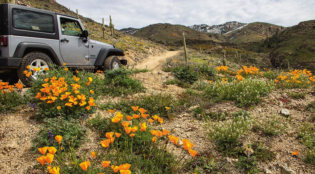
A scenic high-mountain loop that encircles popular Hewitt Station OHV Area. Large staging areas at both ends of trail. We drove this route in late February and had to turn around at Wpt. 03 due to deep, wet snow. We came back 3 weeks later, and all had melted.
(480) 610-3300Tonto N.F., Mesa Ranger District
Check the Weather08/18/2025
Submitted by Tom
Montana Mountain trail over the years deteriorated and became quite challenging and even dangerous. Easy rating was not really applicable any more.
But just now, major maintenance job has been finished! The trail has been fully bulldozered and graded. All real or even potential obstacles have been removed and leveled.
The trail was even widened!
Some people are complaining that the trail is now too easy!
So:
Back to “very easy” rating! Unmodified vehicles and beginners are now again welcomed.
Hurry up, before it will deteriorate again!
05/02/2025
Submitted by Martin
Was on the mountain loop about 2 weeks ago. I was a passenger and am not experienced. Our driver is however. He was amazed at how badly this trail has degraded over the last three years. He said he won’t drive it anymore.
There were a lot of eroded spots with rocks in excess of two feet in diameter on trail that have washed out from above. No room for two vehicles to pass each other. Some parts of the trail no more than six feet wide, probably less.
Just beware before you head up there. At times we had tires right on the edge to get around larger rocks.
I don’t recommend Mountain Loop at all.
05/10/2024
Submitted by Tom
This has been one of my most favorited trails.
Near Phoenix, great scenery, lots of interesting side trails and hiking trails.
Provides access to many of the best hiking trails in Arizona.
However, this trail is deteriorating steadily. Every time, I have visited, it is getting worse and worse.
By now, right after waypoint 2 until waypoint 4 it is definitely not easy, it could even justify difficult rating (moderate rating would be my suggestion).
There are deep erosion ruts and large rocks in the whole section, some of them could be really dangerous. One has to be very alert all the time as some of these are quite hidden on the sides of the shelf road. Other ruts are so deep that are hard to get over, they could cause rollover or equipment damage. I have personally seen vehicles stuck there.
The trail now is not for novice, it needs bigger tires, and even lockers could be put to use here. If you do not have the skills and/or equipment, do not go pass wp2! Kind of shame, it used to be nice, family outing type of trail, but be beware now. On the other hand it, is becoming quite adventurous and challenging for the people who like it.
01/07/2024
Submitted by Kim
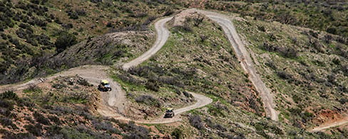
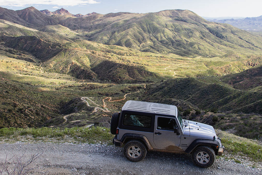
Would call this a sold blue trail w some red portions. We did the loop clockwise on a Wed midday. Lots of traffic both directions which made the challenging sections that much dicier. Would be great if they changed this to a one way trail. As others have noted the trail has many sections of bouldering and fully lifted 4WD is a must if not using a OHV. Fun. Long. Took us 5 1/2 hours due to slow going on both ascent and descent though boulders and tight switchbacks.
10/08/2022
Submitted by David
This trail has beautiful views of the Arizona desert. At waypoint 2, on F.S. 650. The trail changes from easy to what I would consider moderate. There are several switchbacks that require off-camber driving experience. Serval areas where erosion has taken its toll. Took between 5 and 6 hours to drive. I have a 4Runner Off Road with a 2” lift.
8/16/2022
Submitted by Patrick
Took a ride up today in an F250. Great day for a trip, beautiful scenery, saw lots of wildlife. I would probably upgrade this to a moderate trail. There are a few spots with deep trenches and narrow paths along 172. We had to turn around at Roger’s Trough. There are some pretty rough-looking rocks jutting up from the trail on 165 that we just weren’t willing to chance going over. It May or may not be a problem with a jeep.
10/09/2021
Submitted by Tom
This is a very popular trail with lots of scenery. It used to be a piece of cake, well-graded. It leads to popular hiking trails, so hikers use it to access them. In past, I have seen people with rental Subaru’s making it, easily. Not this time, it deteriorated a lot in the last couple of years. Especially lots of erosion, gullies, and down cuts, some of them outright scary, also ruts and deposed sediments. I think it could be quite dangerous for inexperienced drivers right now. We have seen some stuck and some really scared people there! For experienced drivers with good equipment, is not that hard still, but one has to be constantly on the watch, no piece of cake anymore for anybody. It really deserves a Moderate rating now. Hopefully, they will grade it sometime soon. This is supposed to be a hiking trail access route, not an expert 4×4 course.
12/28/2020
Submitted by Kevin
I drove it in a 2021 4runner Pro. Offroad driving experience is really limited, but I’ve had craploads of hardcore mountain biking experience and I think the trail becomes moderately difficult once near the peak and descending through the switchbacks. I would have had a blast descending on a bike but I would have still exercised caution.
11/10/2020
Submitted by Chas
OHV heavy travel last weekend. Slow clockwise travel. Noisy caravaners, gunshots, and hunters in the area. This is an easy trail turning into a moderate trail. Turned around Roger’s Trough due to washed-out rock and lack of information on the condition of the road beyond the site. Jeeps made it through this area without a problem.
08/25/2020
Submitted by Ron
First time on this trail in 2020 Rubicon JLU on August 25, 2020. Large, deep wallowed out area around mile 12.3. FS 650 has several rutted areas and leans more toward moderate. Only saw 3 other vehicles on easy portions of trail — 1 a Fish and Wildlife vehicle. Awesome drive, but lots of smoke from our western wildfires.
05/19/2020
Tonto National Forest temporary closure. Due to several fires, this area has restrictions. Read forest order here. For updates go to N.F. website for alerts and notices.
03/14/2019 and 03/27/2019
Great trail. Only issue is at the end, in order to get back to your truck you will need to...See More
A great experience. Third trip. We went on Mothers Day May 12, 2018. Saw only 4 other Quads and a...See More
Drove this Trail Feb 21, 2021 in a slightly modified 2013 Nissan Xterra. Lower sections are indeed easy, but once...See More
Sept. 09, 2021. Great trial overall. 172A and 650 are more a moderate rating (my opinion: 28 years wheeling in...See More
A great trail system with terrific views of the AZ desert foothills. Literally a FOREST of saguaro in several spots!!...See More