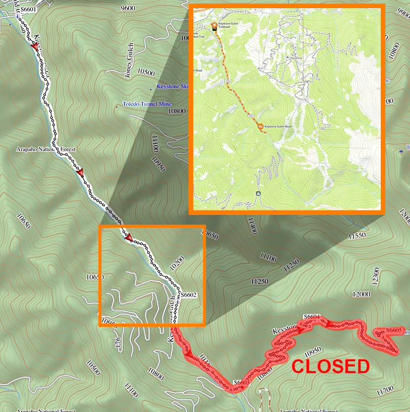
Trail is CLOSED just before Waypoint 02.
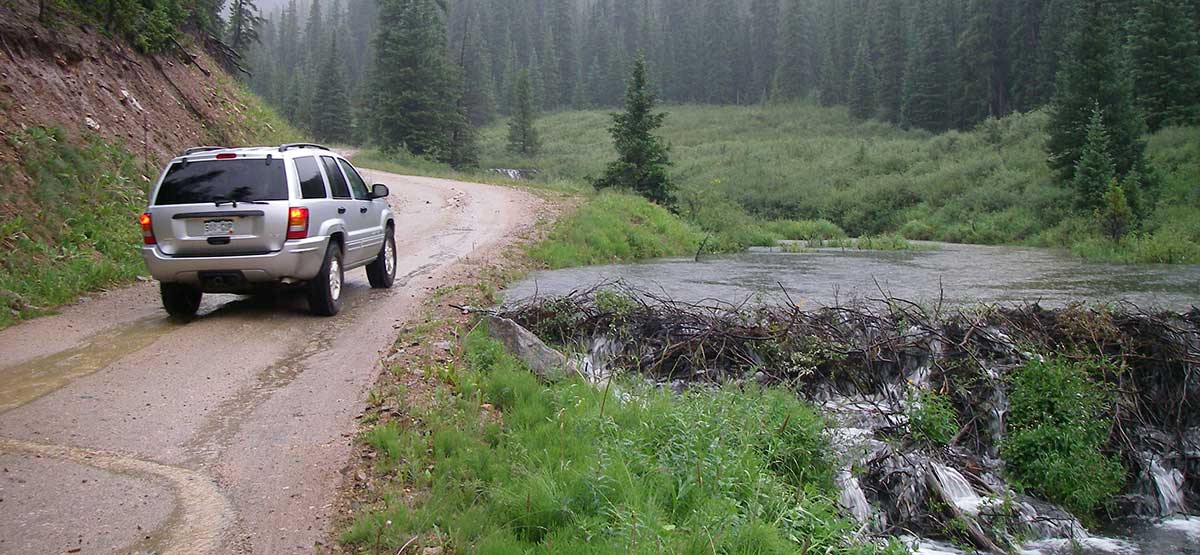
This trail follows a gulch along the west side of Keystone Ski Area, turns east across ski slopes, then climbs to a photogenic mine above the ski area. Lower section of trail follows a stream with classically built beaver ponds. The most interesting part of drive begins after Waypoint 04. If you’ve skied at Keystone, you’ll recognize the “Outback Express” lift.
(970) 468-5400White River N.F., Dillon R.D.
Check the WeatherNo updates yet.
Provide an Update07/22/2023
Submitted by Mark
It seems to be gated to all vehicles only 2 miles in. Bikes and hikers were still allowed past gate.
FunTreks note: The current MVUM shows what customers are reporting. The trail is closed before waypoint 2.
09/22/2022
Submitted by David
I drove it today and found the road closed about 2 miles in. Remote control gate, motor access for keystone resort only. I drove it a few years back with no restrictions.
08/12/2022
Submitted by Chris
Trail is closed with a gate at 2.5 miles. Sign advises construction. Appeared to be more than just a temporary gate.
8-7-2023 we also found the locked gate. A sign on the gate says that hikers, bikers, equestrians are welcome to...See More