Generic selectors
Exact matches only
Search in title
Search in content
Post Type Selectors
Generic selectors
Exact matches only
Search in title
Search in content
Post Type Selectors

High Lakes

1 Review
Location Red Bluff, CA
Rating Difficult,
Length 18mi
Time 6hrs

Vehicle Types

Overview

Weekend destination to fun, scenic OHV area.

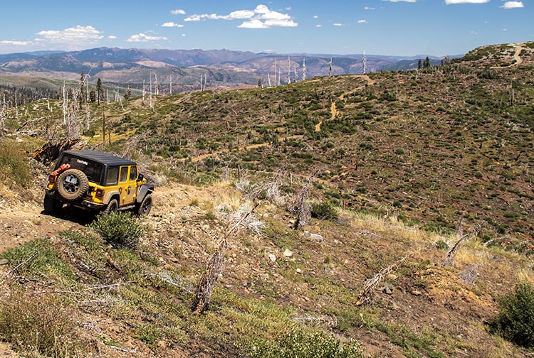
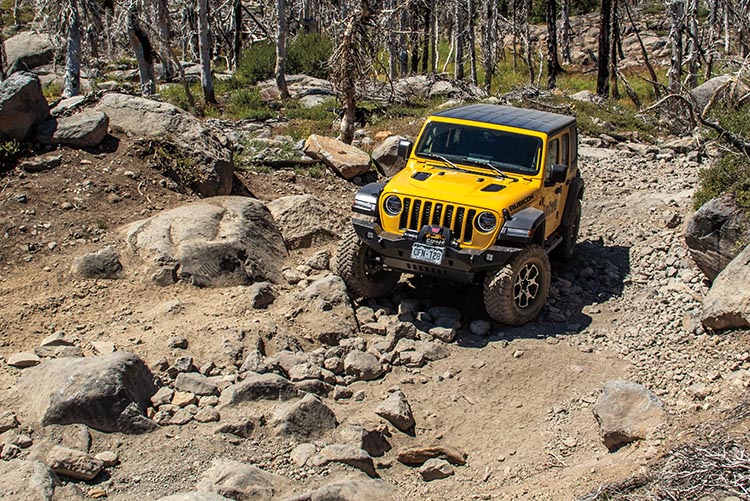
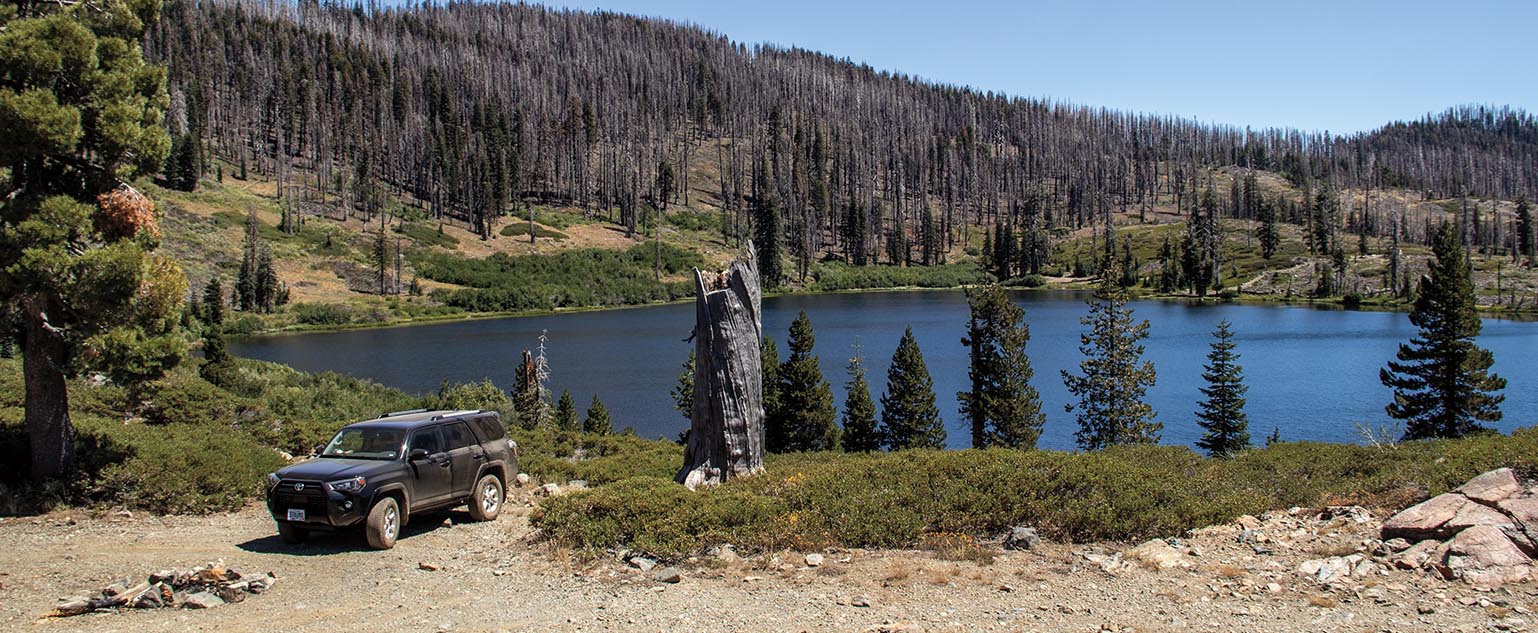
Spend the perfect weekend wandering a beautiful remote high plateau and camping by amazing glacier carved lakes. The High Lakes Off Highway Vehicle (OHV) Area is accessible to green-sticker vehicles and staging is located at Waypoint 03. Be sure to call ahead, as regular fires may occur in the area. Ben Lomond Mountain should only be attempted by smaller vehicles. Stay on designated routes and make sure to pack out your trash.

Rating

Difficult
Trail Ratings Defined

Much of this trail is moderate. After Waypoint 03, expect several rocky spots, tight turns between trees, steep hills, and one mud hole. Stock, high-clearance 4x4 SUVs designed to go off road with an experienced driver can do our described trail. Side trip to Morris lake not for stock vehicles. Vehicles with a shorter wheel-base recommended for this trail.

Stats

Length

18mi

One way

Time

6hrs

High Point

6,542ft

Best Time To Go

May-September

Current Conditions

(530) 258-2141Lassen National Forest, Almanor Ranger District.

Check the Weather

No update yet

Provide an Update

Free GPS download

Reviews

Rate this trail on a scale of 1 to 5.


×

Tracy says

Trail to Morris lake is still very difficult with the upper section being accessible with a standard 4x4 by using the bypass to the left to avoid the waterfall. The lower section is quite a bit more difficult. Getting down to the lake is possible with most 4x4 using one of three passes at the lower section of the trail. All three are quite steep. The lower right-most pass is very rocky with large boulders, sliders and armor should be equipped to avoid damage to your rig. The middle and left bypass are very steep at the crossover and then both converge to a single trail littered with larger loose rocks averaging 12" in size. The right-most train converges into the same trail as the other two right before the bottom and requires a sharp left then right turn to avoid a drop-off and group of trees. The remainder of the trail to the lake is accessible with a sharp in and out creek crossing. The trail can be difficult to follow and might require getting out and walking to make sure you stay on the path. Leaving the lake is where you will have the most difficulty. We went in with 3 Jeep JKU's all lifted, all winched up, all with lockers both front and rear. Two with 37" tires and one with 35". The first rig attempted the boulder section to the left on the way out and quickly became hung up on the rocks. The only attachment points for winching was the boulders themselves and they moved. The first attempt was abandoned and all three jeeps opted for the middle pass. This is manageable until the wall at the last 12 feet of trail. The incline turns to a 50+ degree accent with mud/dirt, ruts and a large root there is very little traction at this point. There is a tree at the top of the hill that is just within range of your wench line and a strap. The angle is not great but the large rocks in the trail provide ways of adjusting your winch cable and angle of ascent. Be careful to not damage your line, protect trees use and use caution when winching.
by Webolutions Digitial Marketing Agency


Cancel Agree