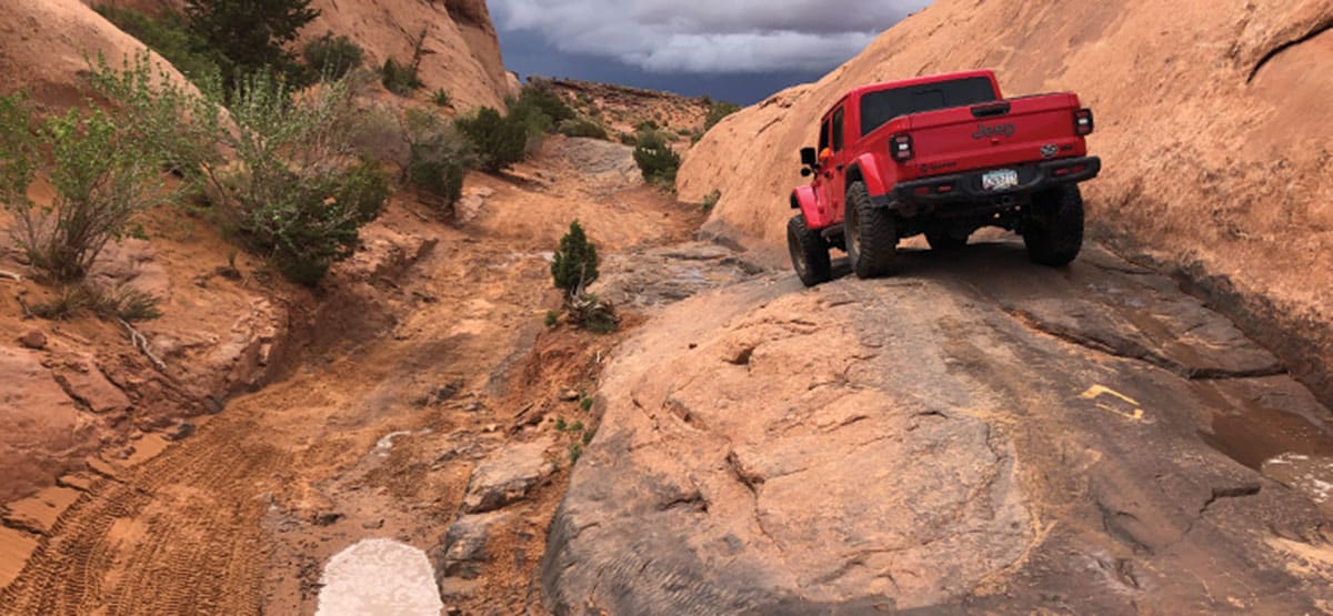
This may be the most popular trail in Moab. It’s very close to town, not too long, challenging in a fun way and amazingly scenic. If you only have time for one difficult trail, this is the one you want to do. The trail is intertwined with the Slickrock Bike Trail. Be very careful at crossing points and remember that bikers always have the right-of-way. There is a fee to enter the Sand Flats Recreation Area.
435-259-2444Sand Flats Recreation Area.
Check the Weather05/05/2025
Submitted by Jeff
Thanks for sharing the updated PDF map; I tested out the “new” exit last year and returned to this website to share the update and see that you included it.
For a little more detail, the new exit is signed as an option, and is named “The Staircase”. I have heard people describing it as a mini Hell’s Gate due to the incline and tire sidewall climbing. The coordinates to turn left and use the staircase exit option are: N38-35.20 W109-32.16 . It ties back into the described trail between waypoints 03 and 04 at: N38-35.16 W109-32.09
In my opinion, the Staircase obstacle can be very challenging in short-wheelbase vehicles, but it is a very nice alternate exit to the trail vs. the back way to Lions Back Resort, which has become VERY eroded with very large ledges and is quite rough.
A fun optional option is to still pass the new exit and do the Tip-Over-Challenge obstacle, then veer right and loop back around on the TOC bypass to exit via the Staircase.
04/04/2025
Submitted by Matt Peterson
As of July 2022, a new cut-through at Waypoint 11 (Tip-Over Challenge) provides an alternative way to exit the trail through the start. Previously restricted to bicycles, this route is now open to motorized vehicles for one-way traffic from west to east. For details, download the updated FunTreks PDF map. A BLM contact confirmed this information.
![]()
05/08/2019
Submitted by Charles Wells
As you pull into the parking lot at the start of the trail, you’ll see a new road on the left marked EXIT ONLY. This new exit allows you to turn around at any point along the trail and return to the start. A new road has been created south and parallel to fin on which you normally enter. It was always a problem getting out there because that fin is so narrow. If you return to the start, you’ll see an exit sign to the right just south of Lake Michigan.