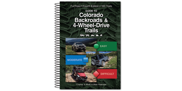
Gorgeous high-elevation scenery and incredible wildflowers. Trail accesses historic mines including the massive Virginius Mine and the Mountain Top Mine. Mines are on private land, so you are not allowed to drive all the way to them. View from a distance and stay out of buildings. Popular trail for Jeep tours. Side trip to Sidney Basin is worth the trip. Roads open to all vehicles May 16 to Nov. 30.
(970) 240-5300Uncompahgre National Forest, Ouray Ranger District
Check the Weather10/16/2022
Submitted by Phillip
This is about the offshoot to Sydney basin. The road marked on the main road to Governor basin is no longer a green. It has several short sections that would be considered read by the standards set on trails such as Yankee boy basin and others. The lower road coming out of Sydney basin is extremely narrow and very much a mental stressor. I would rate the lower Road out of Sydney basin a strong blue if not a lower red just because of the pucker power. Love your book.
2021
Submitted by FunTreks
Due to our findings driving this trail in the summer of 2018, we have changed the rating of this trail to Easy in our 4th edition book from Difficult in our 3rd edition.
We drove Governor Basin on 09/20/18. Other than the shelf road being narrow in a few areas, the trail was...See More
We had trouble with the directions, never did make it off CVamp Bird Rd. Next time we will do some...See More
Open all the way to the top after a delay due to a snowbank blocking the road. Fantastic wildflowers on...See More