Generic selectors
Exact matches only
Search in title
Search in content
Post Type Selectors
Generic selectors
Exact matches only
Search in title
Search in content
Post Type Selectors

Buttermilk Country

2 Reviews
Location Bishop, CA
Rating Easy,
Length 16.3mi
Time 4hrs

Vehicle Types

Overview

Crosses scenic foothills below towering Sierra Nevada Mountains.

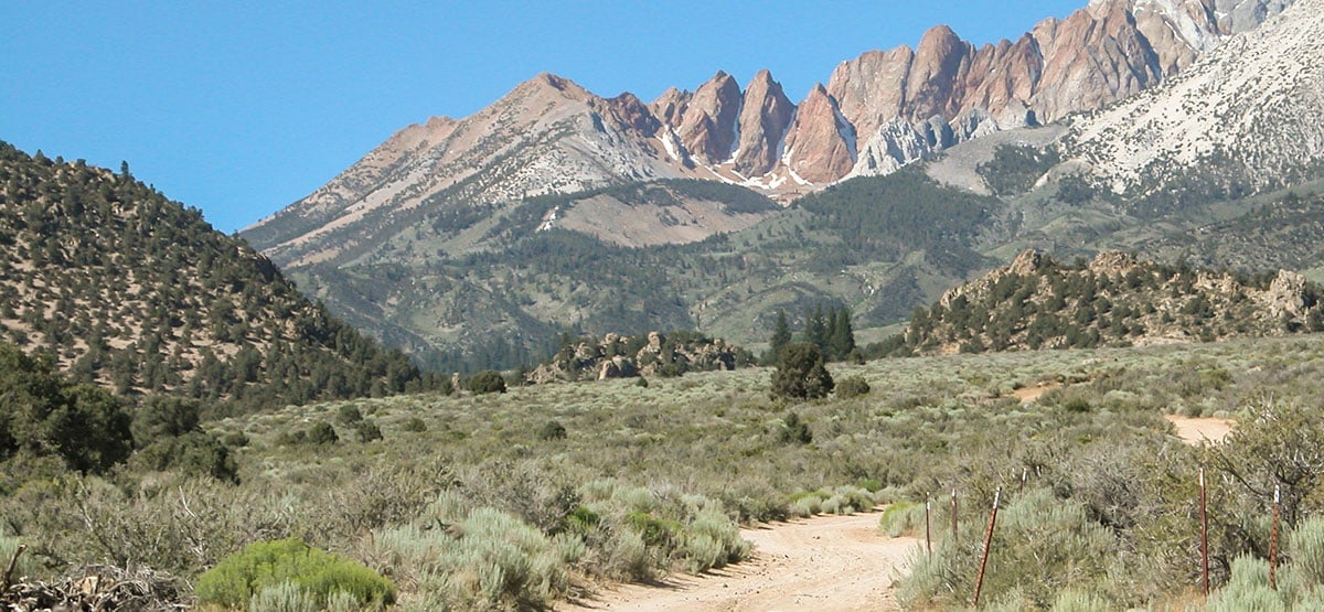
Tour scenic foothills below towering Sierra Nevada Mountains. Drive legal side roads to hiking trails into John Muir Wilderness. Watch for cars on Buttermilk Road for the first 4 miles going to a popular bouldering area near Waypoint 02. Overnight camping is allowed on numerous marked national forest side roads, but not on City of Los Angeles land. Many great roads for green-sticker vehicles to ride. We saw no signs prohibiting greensticker vehicles from using 07S01.

Rating

Easy
Trail Ratings Defined

Variety of dirt roads ranging from smooth gravel to narrow, rocky two-tracks. Challenging, optional side trips on network of marked forest roads (see MVUM). Main route suitable for stock, 4WD, high-clearance SUVs.

Stats

Length

16.3mi

Time

4hrs

High Point

9,172ft

Best Time To Go

May-October

Hot in summer.

Current Conditions

(760) 873-2500Inyo N.F., Mammoth R.D.

Check the Weather

No updates yet.

Provide an Update

Free GPS download

Trail Updates

10/31/2019
Submitted by Matthew
Ran this trail and it is in good shape and makes for an easy run with some great views of the Eastern Sierras. Trail rating is pretty accurate. Enjoy!

Reviews

Rate this trail on a scale of 1 to 5.


×

GaryAuth says

We are an older couple who still enjoy getting out there, but we are not gung-ho 4 wheelers by any stretch. Our vehicle is a stock 2016 Ford F150 4X4, and we did the trip in early October, 2017. It was clear, warm, and dry. The Buttermilk Country loop trail starts out easy with a wide, flat, sandy approach to a popular bouldering area, not far after leaving the highway. Once past this area, we saw not another vehicle on the route! We passed thru foothill pinyon pine, up into dense evergreen forest, then back down again. Surprisingly, we had cell phone service almost all the way. The views are spectacular, passing near the base of Mt. Tom and a couple of other thirteen-ers. We saw a herd of deer near the top of the route. There are a number of side roads (many not marked) so you must pay attention to your FunTreks directions, and/or set your GPS to lat/long to verify your position. Mainly an easy (but narrow) two track, we switched into 4 wheel in some difficult steep spots and stream crossings. One such crossing ponded up and it was difficult to judge the depth because of the color of the water, so I got out a probed with a stick - only about a foot deep. We passed a couple of inviting campgrounds (empty) for those who really want to get away from it all. For me, the most difficult section was on the way back down where we had to negotiate a steep, narrow ridge line (I slipped into 4 wheel and manual shift to keep it in second gear to control my descent speed). Although labeled "EASY" by FunTreks and other guide books, for us it was exhilarating and once back on Bishop Creek Road, we b-lined it to Mountain Rambler to celebrate a fun adventure.
×

Andersen And says

Great trail, however, this is not "easy" - it is moderate. While the first part of the trail is indeed easy, the trail becomes progressively more difficult and towards the end is rocky and narrow. While none of the parts are hard or technical, don't make the mistake of showing up in your Honda Pilot with street tires - a good set of All Terrains absolutely required since a puncture put you into serious trouble going downhill on very narrow shelf roads.
by Webolutions Digitial Marketing Agency


Cancel Agree