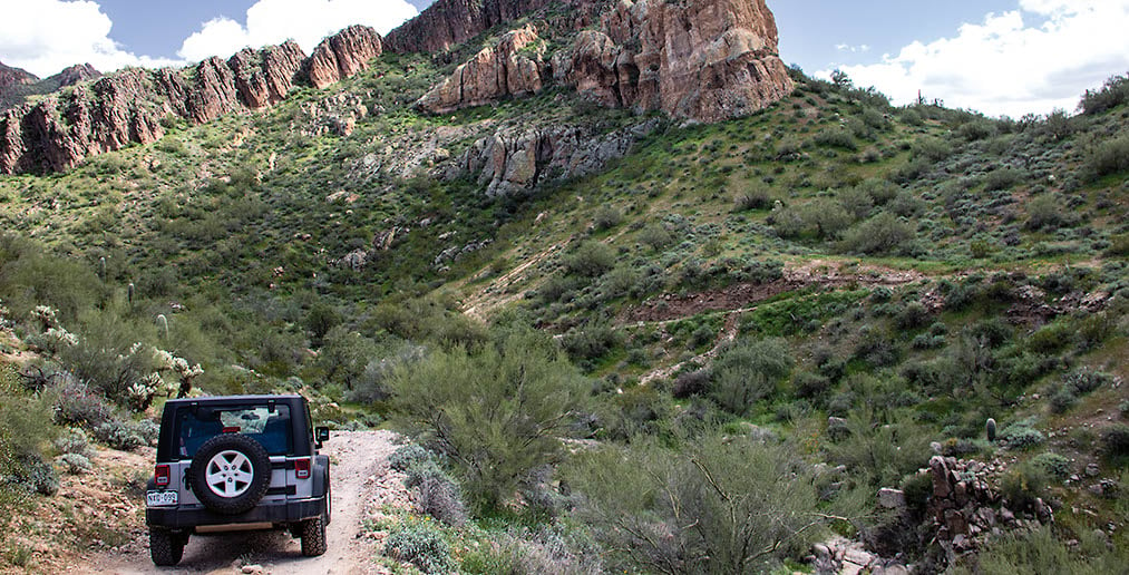
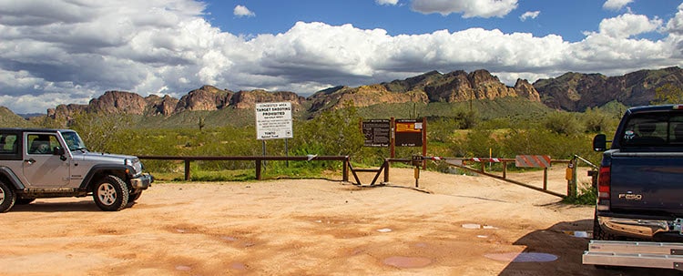
A fun, scenic trail convenient to Mesa and Apache Junction. Trail requires a special permit, but it’s free. The permit gives you the combination to unlock the gates. Call or visit the Mesa Ranger District for details. Trail is open to non-street-legal vehicles. Use marked designated routes only. Great dispersed camping, especially on the north end if you enter as described here.
(480) 610-3300Tonto N.F., Mesa Ranger District
Check the Weather05/31/2024
Submitted by Tom
Trail is still great, but:
1) There is now required permit of $6 (valid for 6 months) available ONLY on web page
Permit information.
2) Forest service banned camping on the trail, removed all the trailers camped there forever and fenced off the camping areas. See
Forest camping information.
10/30/2021
Submitted by Tom
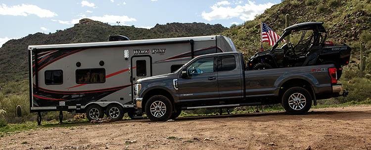
Very popular, a lot of pull-outs and camping areas. Beautiful views. The main trail Fr 10 is getting harder and harder. More erosion. A spotter is needed. But it is still moderate. I hardly recommend using the side road FR3554, which is an easy, funny sandy drive with great views. Real fun to drive! The best sandy road near Phoenix. Fr 1356 is easy too. We also tried FR12. I would rate this one as rather difficult, spotting was needed all the time. Fr 12 is not marked so navigation was also a challenge.
10/03/2020
Submitted by Ryan
Really washed out on a few clubs and downhill sections. You’ll want a spotter. I took a stock Rubicon through and got some curb rash on one for the wheels.
A permit is now obtained online from Recreation.gov for $6 and good for 6 months.
8/28/20
Submitted by Ron
We drove the section from Blue Point to Wolverine. Several well-rutted sections and rocky for much of the trail. We were in a stock Jeep Rubicon. I would not drive this in most stock SUVs. Great trail.
01/12/2020
Submitted by Tom
There has been some major erosion. The hard parts are harder, lots of rocks and ruts. I needed a spotter in one area. I would say the moderate rating is more suitable now. Great track, beautiful views! We had a great time. Very close to Phoenix.
01/08/2020
Submitted by Eric
The trail is washed out and rutted. Definitely a fun trail, but would rate it Moderate. 4WD definitely needed (or 2WD with locking diff). We drove from Blue Point off Bush Highway to Wolverine Entrance. Plan to drive Wolverine Entrance to Cottonwood Entrance at a later date.
09/03/2019
Submitted by Laura
I ran the trail today starting at Blue Point FR10 then over to 1356 like in the book. This was my first off-road trip and I picked it because it was rated easy. I figured I could get an easy run-in. I am reporting that Easy is no longer the case, I would say that it is Moderate. It is very rocky, rutted and washed out. I wound up going over 3 steep hills which were pretty rough. Good trail and scenery though.
04/27/2019
Submitted by Laura
Would rate this as moderate. The 2 miles from 3554 to blue point gate was easy, but from wolverine entrance to 3554 it is very rocky and rutted. Rear locker helpful to get up the steep hill as it was really loose. Looks like it hasn’t been maintained compared to the pictures in the book.
03/13/2019
Submitted by Charles Wells
We will be changing the rating on this trail from easy to moderate. It was much more washed out and rutted than the last time we drove it. The rating often changes on this trail due to occasional maintenance. See notes from the update below.
01/09/2019
I started this trail as listed in the book starting at the Blue Point entrance. My update is that this is in no way an easy trail. The trail should be updated. The sections between waypoint 1 and waypoint 3 are for sure not suitable for a stock vehicle. There are some spots near the end of the trail as you get closer to the Cottonwood entrance that is more difficult as well. I would rate this trail as Moderate. The most difficult parts of this trail are the most scenic. Amazing views on this trail and in my opinion really worth doing especially if you appreciate scenic beauty.
I entered the route at the Blue Point Entrance. Easy grit surface, as shown on your 3 photos, constituted half...See More
January 24, 2018 I drove the trail starting at the Wolverine entrance heading north on #10 to the Blue Point...See More
Drove this from Usery Pass all the way including the optional side trip on 1356 at the end. 2020 4Runner...See More