Generic selectors
Exact matches only
Search in title
Search in content
Post Type Selectors
Generic selectors
Exact matches only
Search in title
Search in content
Post Type Selectors

Bloody Basin Road

2 Reviews
Location Crown King, AZ
Rating Easy,
Length 38mi
Time 8hrs

Vehicle Types

Overview

Great SUV trip to ruins, petroglyphs and suspended foot bridge.

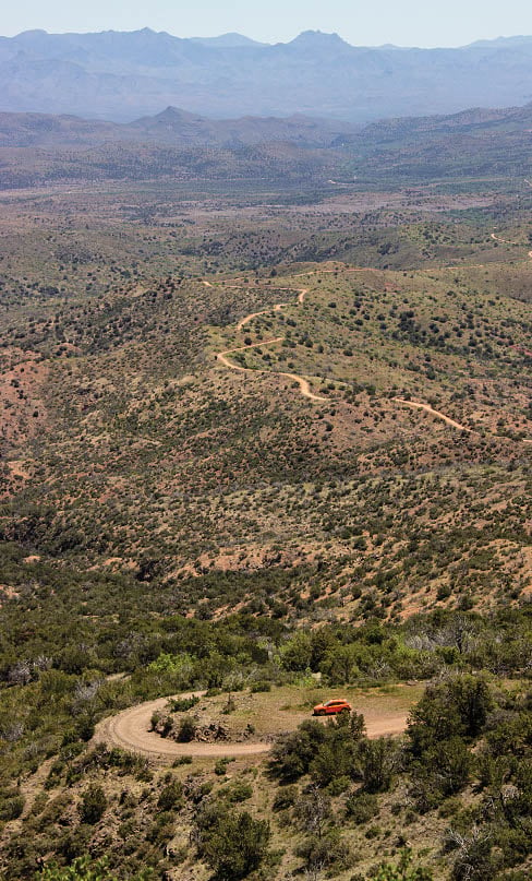
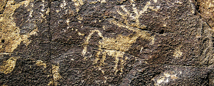
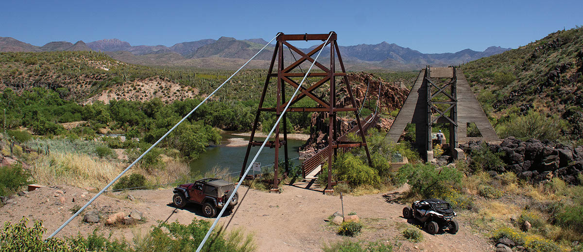
Much of this long trip passes through Agua Fria National Monument. Take time for side trips to see archaeological sites and petroglyphs shown on map. The highest point of the trip nears 5,000 feet, where you’ll enjoy expansive views on a clear day. Non-street-legal vehicles are allowed throughout the area. There are natural hot springs hidden in thick brush below and slightly north of the bridge on the west side.

Rating

Easy
Trail Ratings Defined

A well-maintained road that gets a bit rockier as you descend to the bridge. Wet weather creates muddy conditions, especially on side trips.

Stats

Length

38mi

Time

8hrs

High Point

4,954ft

Best Time To Go

Spring/Fall

Current Conditions

Free GPS download

Trail Updates

08/09/2021
Submitted by T
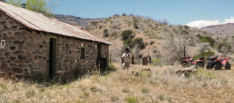
At Waypoint 04, the road to the right to go to the old stone cabin is 578 but shortly then vears to the left and is 3170 the rest of the way to the cabin. The guidebook map has this noted as a 9014 (not 3170).

05/31/2021
Submitted by Don
The road going east after carefree road is very rough and rocky. Max speed about 5mph for 11 miles one way.

03/27/2020
Submitted by Matthew
First, this is 37.5 miles one way from Hwy 17. You can top of your gas tank at Cordes Junction, exit 262 before you start. This trip will take you all day. The road is well-graded gravel road until you get to the creek crossing at Indian Creek. That was the deepest creek crossing of the trip. From there the road is good but starts to get bumpy and you will pass through some beautiful country. The road continues to be rougher in some spots until you reach the creek crossing near Dougan Ranch and then the road becomes very rough. From here you will proceed much more slowly until you arrive at the Sheep’s Bridge. The bridge is worth the trip. There are a few information monuments that give information on the bridge. While this was a long trip, everyone felt it was worth it and I would wholeheartedly agree. We did exit back through Bloody Basin Road. I would rate this as an easy run that can be done in even an SUV.

Reviews

Rate this trail on a scale of 1 to 5.


×

Josh says

Just did this trail last friday. Road is definitely eroded with the rains we have had this winter. We were able to complete the trail in a group that included a 2018 stock 4-runner, a 2018 Taco TRD, and a 2000 Jeep TJ Sport 4.0 with no lockers. Rough ride, higher clearance recommended and 4x4 is a must.
×

Thomas says

Long trail, bur easy and scenic. Very busy, popular for camping and picnicking. We saw all kind of vehicles including car and homeless pair pushing supermarket cart! Unfortunately also SUV with broken axle. The route from last crossing of Tangle creek to the Sheep bridge (last 10 miles) is the hardest. I would not take low clearance vehicle on that part of the route, but some people did. Nice shady spots for picnic at Sheep bridge and Tangle creak crossings. Warning, route crosses several major creeks. In case of stormy weather you could get stuck at the bridge for substantially longer than you have planed. Or even drown in flash flood. If you are street legal, I would recommend to make it one way route by using FS 24, Cave Creek Rd. This one is about as difficult (easy) and scenic as the Bloody Basin Rd.
by Webolutions Digitial Marketing Agency


Cancel Agree