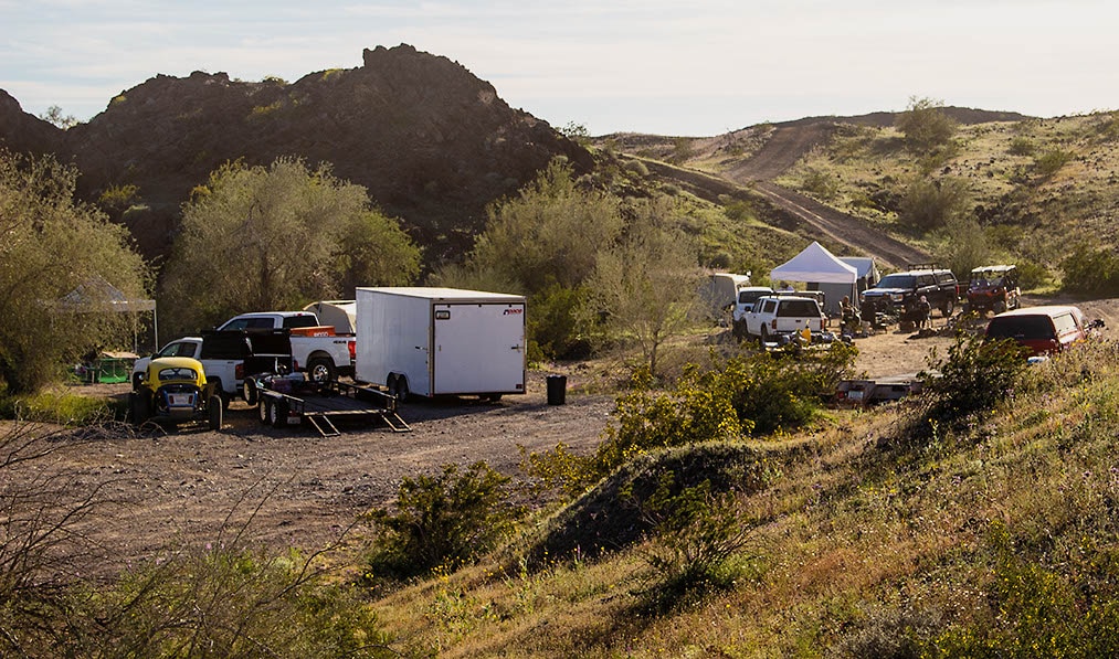
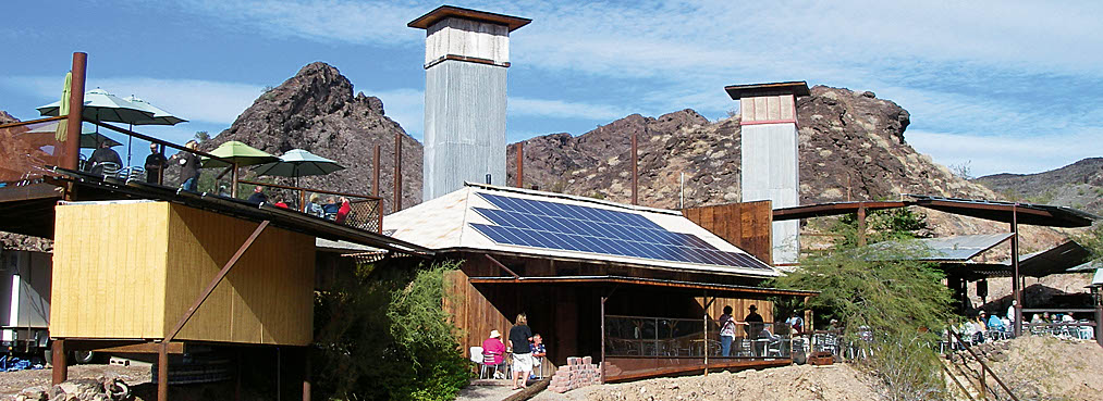
The Desert Bar, aka Nellie E. Saloon is a popular hangout north of Parker. Most people drive to it via easy Cienega Springs Road. Local 4-wheelers showed us this more challenging backway through the rugged Buckskin Mountains. The area along Cienega Springs Road has become a major draw for hard-core Jeeps, UTVs and non-street-legal vehicles. Here you’ll find lots of dispersed camping and numerous side trails to explore, some very difficult. Contact the Parker Four Wheelers for more information about this area.
Check to see when the bar is open. http://www.thedesertbar.com/
(928) 505-1200Bureau of Land Management, Lake Havasu Field Office
Check the Weather09/05/2023
Submitted by Robb
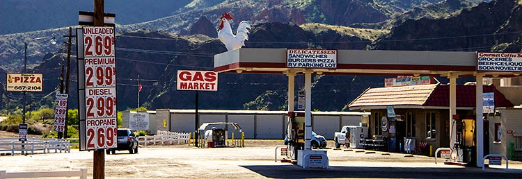
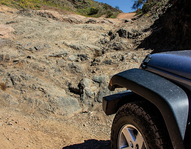
Our annual winter snowbird always included 3-4 days a Rivers Bend State Park, but we have never tried the trail until this year. We were with five others from our ATV club in BC, They did the trail all the way to the bar (weekday so it was closed), and my wife an I did half the trail on another day. We are both in our 70’s so we tend to be a little cautious when we are riding alone (we ride a pair of Can Am outlander 2 ups). In previous years the rock waterfall at the start seemed pretty rough. this year it seems to have been worn down some and it was very easy for both of us especially with quads and favoring the left side. The trail is not well marked so use the good descriptions of waypoints here. With the exception of one short heavily rutted uphill a little over a third of the way in, and one short downhill section that had some off camber to it, the rest of the trail I would consider easy to moderate. Great scenery in the first half, and lots of offshoots. Great camping at Rivers Bend State park with a trail along the south side of the highway to the “Rooster” Market ” less than 1/2 mile, then behind the market to the trail.
03/22/2019
Submitted by Chuck Wells
This trail is now very difficult. There is a steep rock wall at the very beginning. I checked all the little side shoots and found no bypass. In addition, there are several steep, narrow sections on the last part of the trail that are very rocky with side erosion. This being said, I drove the entire trail in my stock Wrangler Sport. It was slow going in spots, but with careful tire placement, I got through just fine. The portion between Waypoint 02 and 03 in the book is well marked with BLM posts showing it as part of a loop called the “Gray Eagle Mine Trail.” There are many side roads to explore along Cienega Springs Road. This area has become a UTV mecca. I saw several large groups of campers along the road. Not sure how I missed the large rooster on top of the gas station and market at the start of the trail. This obvious landmark makes it easy to find the trail.