Overview
Simply plug the card into your GPS unit and see your exact position as you move along the trail.
The card is compatible with Garmin Drive Series and Garmin Overlander (not TREAD Overland Edition). Garmin devices using the Garmin TREAD app will not be able to use the card.

Details
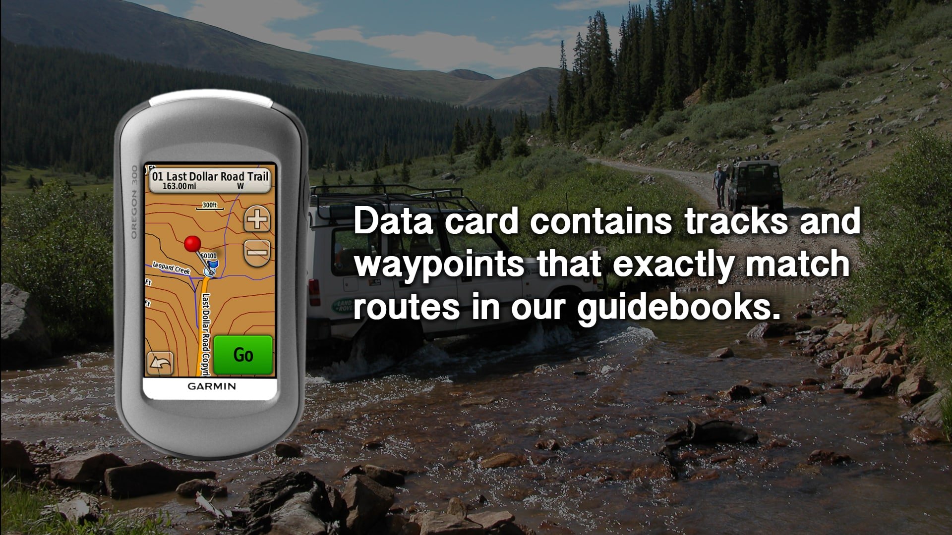
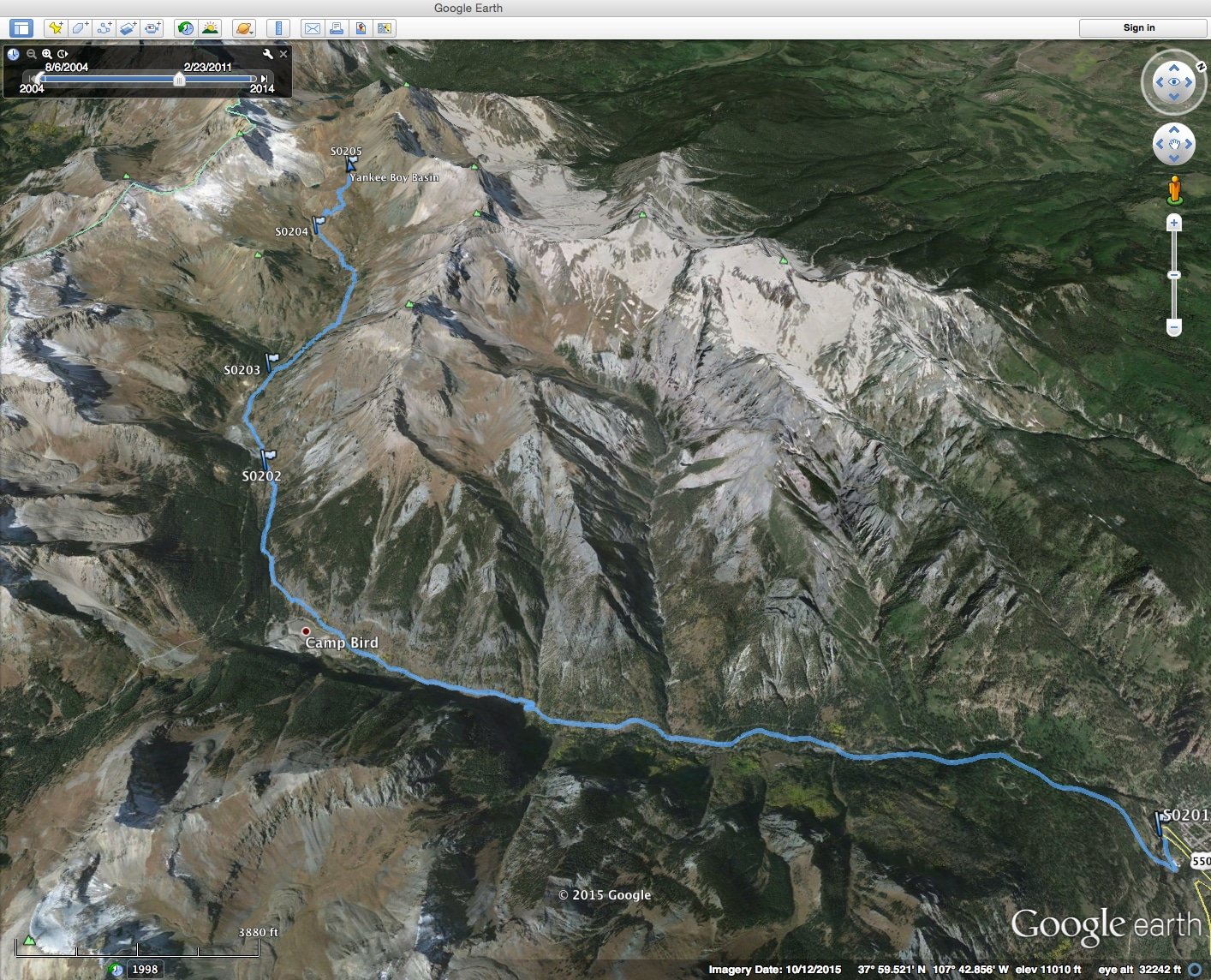
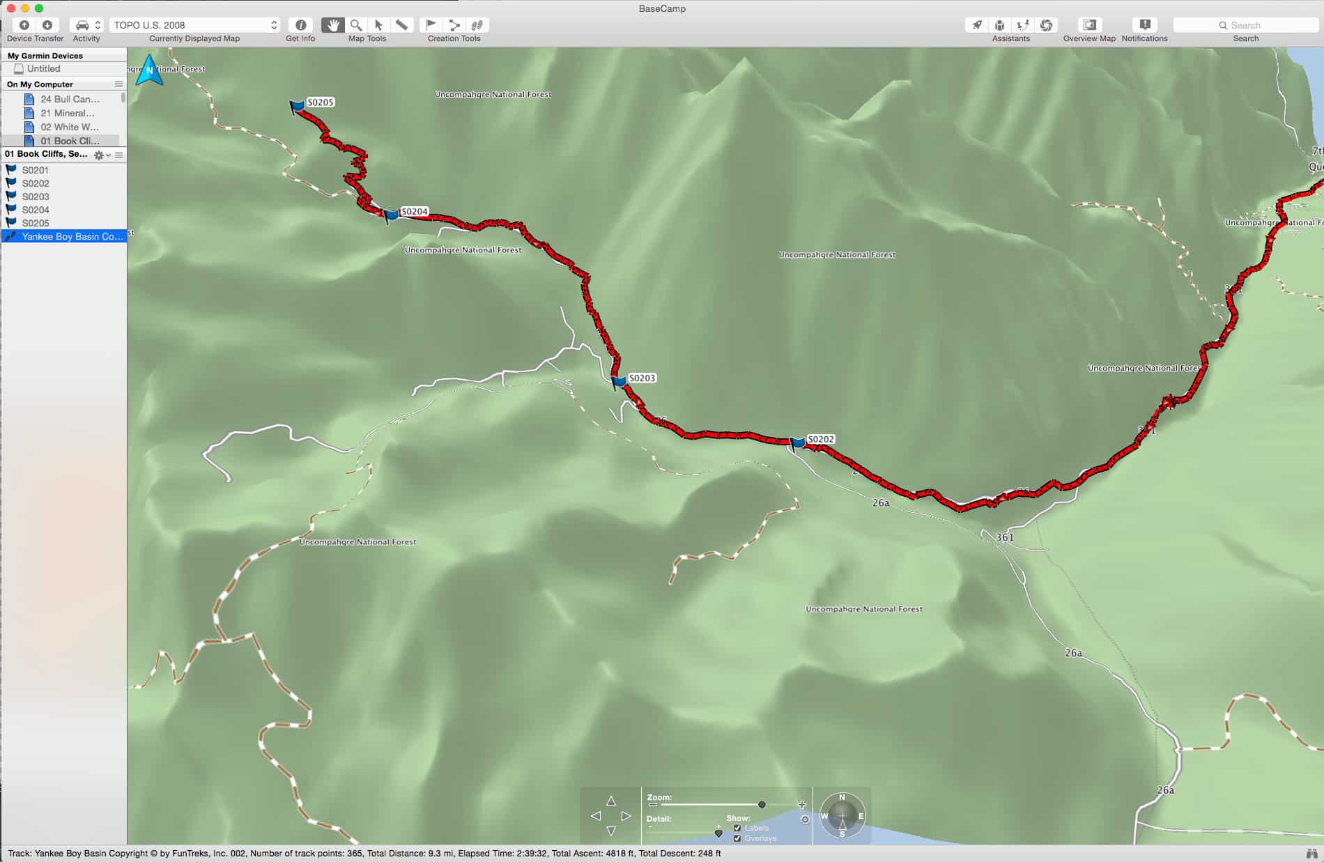
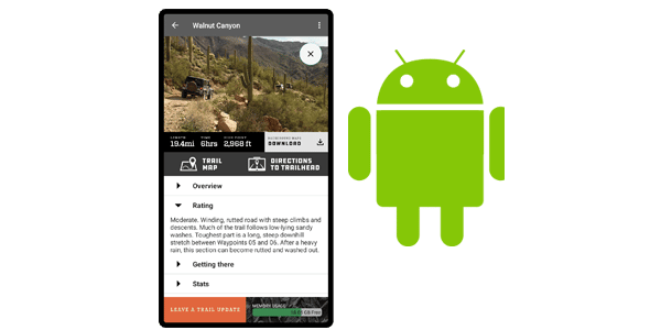
Routes match the guidebook (Guide to California Backroads & 4-Wheel-Drive Trails) and are shown on pre-loaded topographic backgrounds. You’ll see your exact position on your GPS screen at all times. This card is intended to be used along with the books, which include important information, not on the card, including trail overview, trail rating, vehicle recommendation, photos of the trail and more.
What is on the data card?
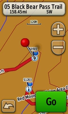
Start of Trail & Points of Interest (POIs)
Each FunTreks data card includes the start of each trail from the corresponding book as a custom Point of Interest. Once the card has been inserted, some receivers will ask to import the POIs from the FunTreks data card. We do not recommend importing the POIs to the receiver due to the limited amount of internal memory in most units.
Tracks / Breadcrumb Trails
Tracks that correspond to the complete trail in the book are included on the topographic maps on the data card. Your unit will also show the waypoints that correspond to the waypoints in the book.
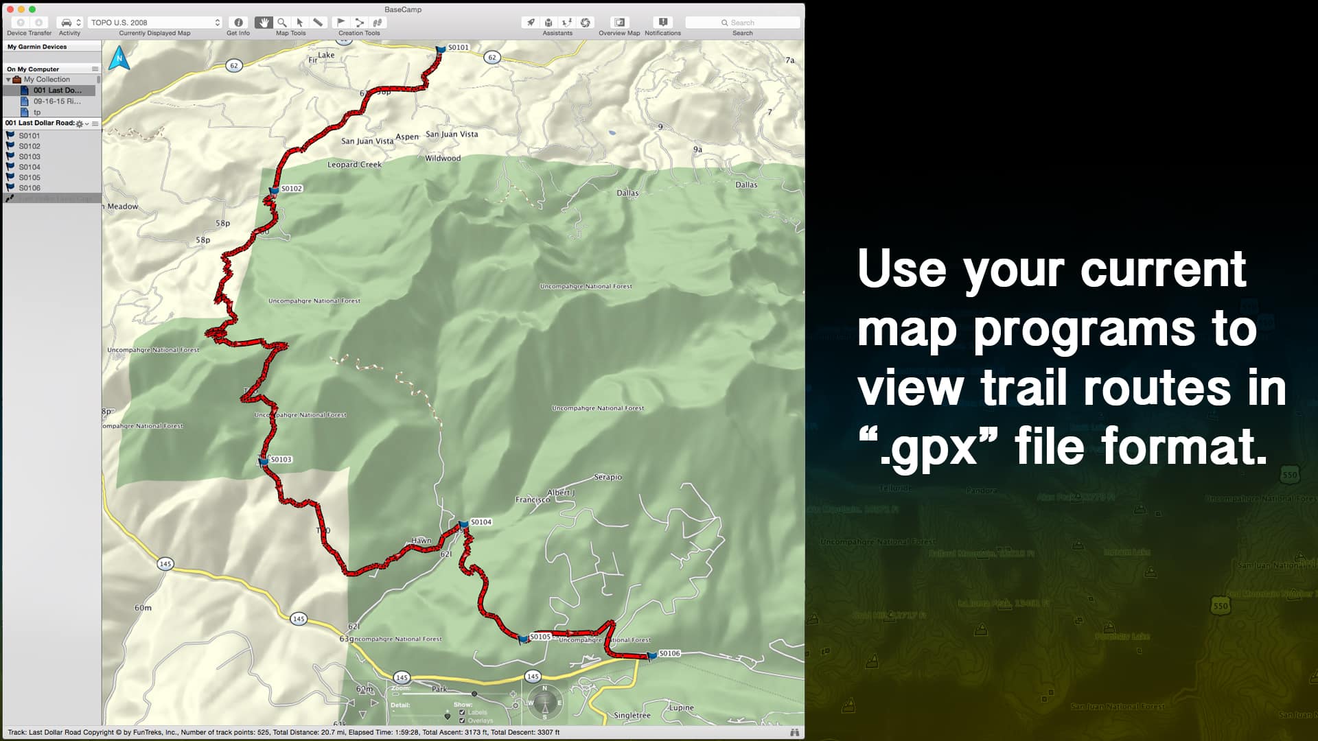
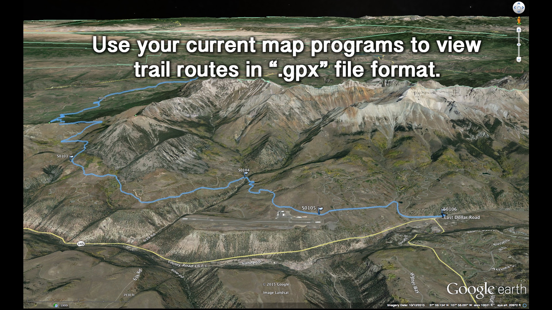
Files in GPX Format
All FunTreks Data Cards include GPS Exchange Format (GPX) files that will work with nearly every GPS unit and computer program that supports GPX files. Some tablet devices may be able to read these files as well.
Other Non-Supported Uses for GPX Format
Consult the user manual for your software/device on how to use GPX data with these applications.
The card is compatible with Garmin Drive Series and Garmin Overlander (not TREAD Overland Edition). Garmin devices using the Garmin TREAD app will not be able to use the card.
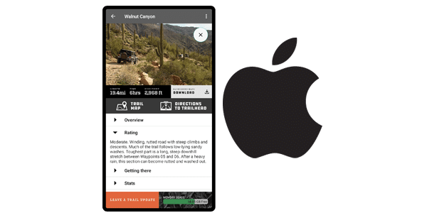
Do you want the easiest way of seeing yourself on the trail with GPS? Try our App.
FunTreks, Inc grants a non-exclusive perpetual personal-use license for files on these data cards, subject to the following restrictions: Data cards are intended to be used with FunTreks Guidebooks and not as a stand-alone map. This license is for personal use only. Personal use means non-commercial use of the files for use on personal computers, GPS units, or mobile devices. This file may not be used in any way whatsoever in which you charge money, collect fees, or receive any form of remuneration. This file may not be resold, relicensed, or sub-licensed, or listed on any website, forum, newsgroup, ftp or web server, or other online location. Title and ownership, and all rights now and in the future, of and for this file remain exclusively with the FunTreks, Inc.