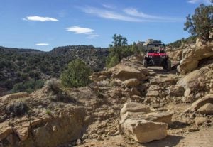
 While researching and driving trails in Moab, UT we had heard from a local Moab veteran about The Swell, an area to the west of Moab that offered amazing trails with unique scenery for unlicensed vehicles. It had been his go-to spot for years. He lent us the only map he had ever found, on the condition that we would promise to return it. Early in the morning, with a few ideas on where the staging area was and a promising route to follow, we eagerly set off.
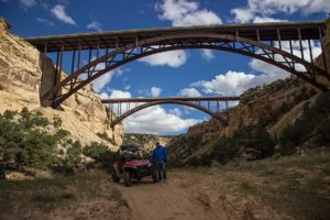
It is a rare treat when we get to explore new areas without a local guide present. This was real exploring on our own which everyone knows makes for lasting memories – good or bad. So we headed north from the staging area, an area where wild horses are known to roam free, and quickly climbed to an overlook. From there we could see the interstate crossing a deep canyon. We could make out a small faint trail underneath the roadway high overhead. With the excitement and hope that our trail would end with us down under the bridges, we pressed north.
With the excitement and hope that our trail would end with us down under the bridges, we pressed north. We knew that we were in for an adventure, and we were eager to explore this hidden gem of Moab. We had heard from other adventurers that The Swell was a great place to find hidden trails and amazing scenery, and we were determined to find our own. We followed the map that the local Moab veteran had lent us. We knew that there were many other hidden gems even near the places we lived, and we were determined to find them all. So if you are also excited to find great places like this you can get the info here. The Trajet has all the places you would like to visit which are still not popular but great spots to go.
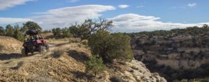
The trail followed high, rocky shelf roads bordered by steep descents to the bottom of the stunning canyon. The scenery was epic. It left us thankful of what you can see and enjoy from the seat of a UTV.
We soon realizedthat we had stopped so many times to take pictures, we had taken up a lot of time. Knowing that we still had a lot of miles to cover, we decided to pick up the pace.
The slow-going rocky terrain ended as we entered North Fork Coal Wash. We now could enjoy a little speed through soft sand and shallow water. We reached the northern most point of our trip and took a small hike up a washed out section of the canyon for lunch. From there the trail follows South Fork Coal Wash where we enjoyed more fast trail riding. Using the map that we figured was a ‘unicorn’ due to howrare it was to find, we quickly found our turn leading out of the wash.
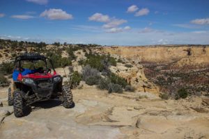 The next few miles we headed south on The Devil’s Race Track – fast, twisty sections of sand, slow, moderate rock crawling and more shelf roads with jaw-dropping views. This section of the trail impressed us the most and as we looked around in awe of what we were experiencing, we got to wondering why the devil always seems to get the fun stuff?
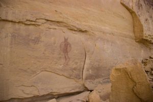
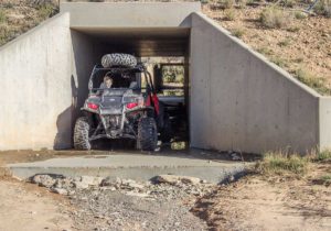
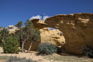 The trail tamed down and got easier as we reached Dutchmen Arch. Here you can get up close to the arch or even camp at the base of it. Next, we slipped under the interstate through a culvert in order to reach the network of trails on the south side. We took some fast dirt roads on a quick side trip featuring some well-preserved rock art.
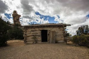 Next up was Swasey’s Cabin and The Ice Box where we stopped for some exploring and some quick history lessons from information boards. We left the cabin and dropped down into another wash with moderate terrain consisting of embedded rock and sand. We knew that we were getting close to the underpass we had seen earlier. We finally reached the section under the interstate that caught our eye from the first overlook earlier that day. What a view to end a beautiful day of riding!
Most of the main roads are well-graded and allow good access for RVs and trailers. You can find plenty of open camping just a mile north and south of the Interstate from exit 131. We saw many people camping and thought that was the best option. You can also camp near the southern part of the area in a well-defined camping area near Temple Mountain and Goblin Valley State Park. The area is remote and the nearest gas can be found in Green River or traveling south to Hanksville. NOTE: Emery County OHV laws allow unlicensed vehicles on most non-paved county roads seen on this map.
Since this epic adventure, we have been back twice and seen over 2,000 miles of OHV trails crisscrossing this stunningly beautiful area. I can’t think of another trail that could compare to how much this one offers both driver and passenger.
The Swell
BLM Filed Office: Price
Start of the trail: N38° 50.702′ W110° 53.608′
Rated: This trail offers everything from easy, fast washes to slow rock climbs. It should be considered a difficult trail because to complete the loop you need to drive Devil’s Racetrack.
Time and Distance: Plan for the whole day. Almost 43 miles.
Staging: From exit 116, use the south frontage road heading east to a large and flat parking area. Unload and drive north through a small culvert under the Interstate.
You will find detailed trail info including 5 more equally amazing trails in this area in the Guide to Moab, UT Backroads & 4-Wheel-Drive Trails 3rd Edition.
To learn more go to www.Funtreks.com or call toll free 877-222-7623.

Comments